
 by admin
The gardens of Medina Azahara were much more than decoration: they were a key part of the caliphate’s message of power. Abd al-Rahman III built his palace city on the slopes of the Sierra Morena and used the gradient to create stepped terraces where water, plants and architecture combined to impress every visitor. Here is how those terraces worked, what remains of the gardens and how to recognise them during your visit.
A city built on terraces in the Sierra Morena
When Abd al-Rahman III decided to found his new city around 936-940, he chose a site about eight kilometres west of Cordoba, at the foot of the hills. The ground was not flat, and that was exactly its advantage. The builders cut into and filled the slope to create three large platforms, each with a different function.
At the top stood the caliph’s residence and his most private quarters. The middle terrace held the official and ceremonial buildings, with their gardens. And the lowest one contained the city itself, with houses, workshops and the main mosque. This stepped layout meant the main halls overlooked the whole Guadalquivir valley, an idea we explored in our post on the Sierra Morena landscape in the 10th century.
The garden as a stage for power
In Andalusian culture the garden evoked the image of paradise, but at Medina Azahara it also worked as a political stage. Ambassadors coming to see the caliph walked through carefully laid-out open spaces before reaching the reception halls. The sense of order and the abundance of water and greenery were in themselves a display of the wealth and control of the Umayyad state.
The Upper Garden, in front of the Salón Rico
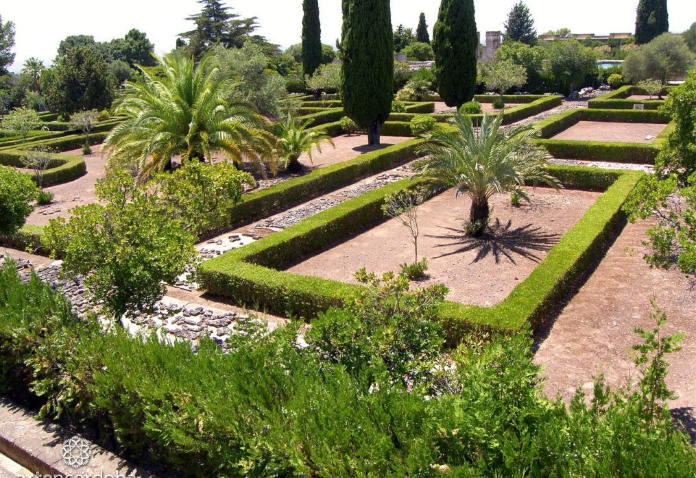
The best-known garden is the so-called Upper Garden, which stretches in front of the Salón Rico, the great reception hall built between 953 and 957. Its design follows the four-part garden model: two main raised walkways cross at right angles and divide the space into four large beds.
In the centre stood a pavilion surrounded by pools. The water acted as a mirror that doubled the image of the hall and the pavilion, and it also cooled the air in the hot months. The result was a carefully calculated visual axis between the caliph’s seat and the open landscape of the valley.
Sunken flower beds, a very Andalusian technique
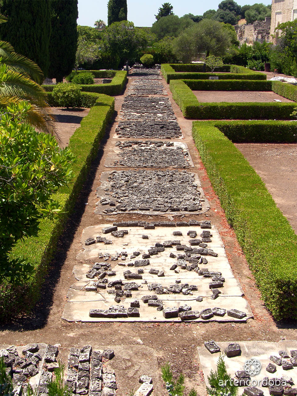
One of the most interesting features is that the beds were sunken below the walkways. Anyone strolling along the paths had the treetops and flowers almost at eye level, as if walking on a carpet of plants. This solution would later be repeated in other gardens of al-Andalus and is one of the keys to understanding Hispano-Muslim garden design.
Water: the hidden feat of engineering
Keeping gardens, pools and fountains on a hillside required a constant water supply. The caliphate’s engineers reused and extended an old Roman aqueduct, known today as the Valdepuentes aqueduct, which brought water down from the hills. From there, a network of channels, tanks and conduits distributed it by gravity across the terraces.
The same system also supplied the city’s houses and services, which ties in with what we explained about the architectural secrets of Medina Azahara. Without that infrastructure, gardens would have been impossible in such dry summers.
What grew in the gardens
No detailed inventory of species survives, but Andalusian texts on agriculture and gardening give clues about what was common in palace gardens: fruit trees, citrus, myrtle and aromatic plants, chosen for their colour, shade and scent. The planting you see on site today is an approximate recreation that helps you picture the original look.
How to see the gardens during your visit to Medina Azahara
From the Salón Rico area you can clearly make out the layout of the Upper Garden and the difference in level between the terraces. Stop at the edge of the platform and notice how the walkways lead your eye towards the valley: it is the best way to understand that the landscape was part of the design.
Bear in mind that not every area is open, as the site is still being excavated and conserved. Early morning and late afternoon offer the best light for photographing the terraces.
Frequently asked questions about the gardens of Medina Azahara
How many terraces did Medina Azahara have?
The city was organised on three large stepped terraces on the slopes of the Sierra Morena. The top one housed the caliph’s residence, the middle one the official buildings and ceremonial gardens, and the lowest one the city with houses, workshops and the main mosque. This layout visually reinforced the hierarchy of caliphal power.
What is the Upper Garden of Medina Azahara?
It is the large garden in front of the Salón Rico, on the middle terrace. It follows the four-part model, with two crossing walkways dividing the space into four beds, and had a central pavilion surrounded by pools. It was the setting for the caliphate’s great official receptions.
Can you visit the gardens of Medina Azahara?
Yes, the Upper Garden area is part of the usual route around the archaeological site and is viewed from the walkways near the Salón Rico. Some areas may be closed for conservation work, so it is worth checking the site’s status before you go or visiting with a guide.
Where did the water for the gardens come from?
Water came down from the hills through an old Roman aqueduct, the Valdepuentes aqueduct, which the Umayyads reused and extended. A network of channels and tanks then distributed it by gravity across the terraces, supplying pools, fountains, gardens and houses throughout the palace city.
Walking the terraces of Medina Azahara is the best way to understand how a 10th-century caliph thought. If you want to discover every corner and its meaning in detail, join our guided tour of Medina Azahara.


